
Archaeological Area at IKEA Anagnina
A landscape before the city.
Long before this part of Rome became a landscape of roads, retail buildings and the Grande Raccordo Anulare, it was organised agricultural territory.
Preventive archaeological investigations carried out before the construction of the IKEA complex at Anagnina revealed evidence extending from the late sixth century BC through the Republican period and into the first century BC.
The excavation did not reveal a single isolated monument. It exposed traces of a working landscape: routes, agricultural installations, planting systems and structures associated with the storage and management of produce.
Part of that archaeological record was retained within the modern complex. The result is one of Rome's most unexpected encounters between contemporary infrastructure and the material organisation of the ancient countryside.
Not a ruin. An agricultural system.
The archaeological importance of Anagnina lies in the possibility of reading land use rather than simply the remains of a monumental building.
Archaeological research has identified an agricultural settlement and systems connected with the organisation and improvement of cultivated land. The documented sequence extends across several centuries.
Later studies of the Roman suburb have also referred to planting trenches on the IKEA site interpreted as evidence for vineyards, with several phases of use across a broad area.
These traces provide evidence for the economic landscape that surrounded Rome: cultivated plots, routes, storage facilities and repeated modification of the terrain.
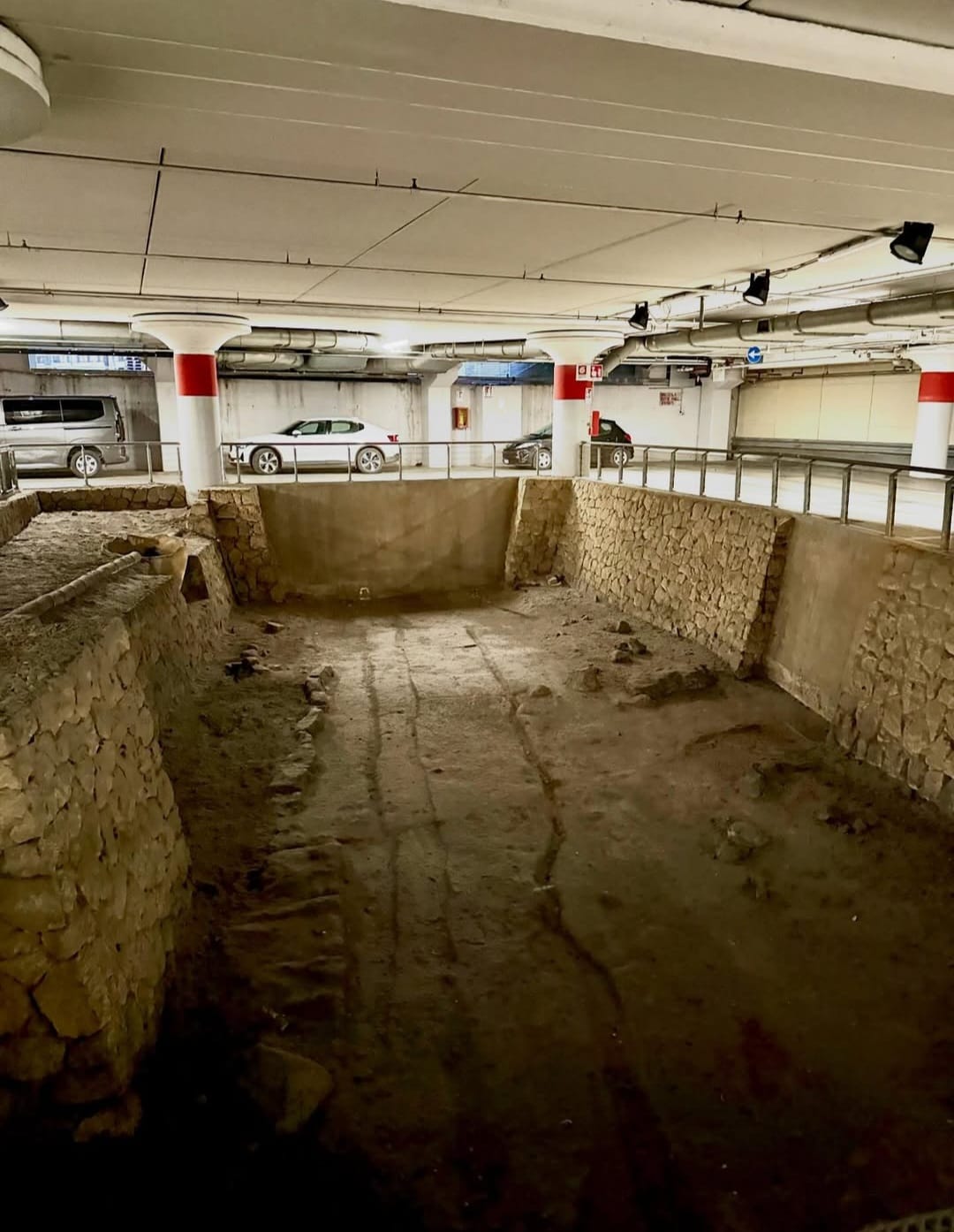
Centuries of cultivation written into the ground.
The site is particularly useful because its archaeology records change through time. Agricultural landscapes are rarely static: plots are reorganised, planting systems are replaced, routes change and structures acquire new uses.
The archaeological evidence at Anagnina therefore belongs to a sequence rather than to a single date. Official SITAR material summarises the excavated agricultural settlement and land-management installations as extending from the late sixth to the first century BC.
Early agricultural organisation
The earliest phases documented by the investigations belong to the late Archaic period.
Storage and productive activity
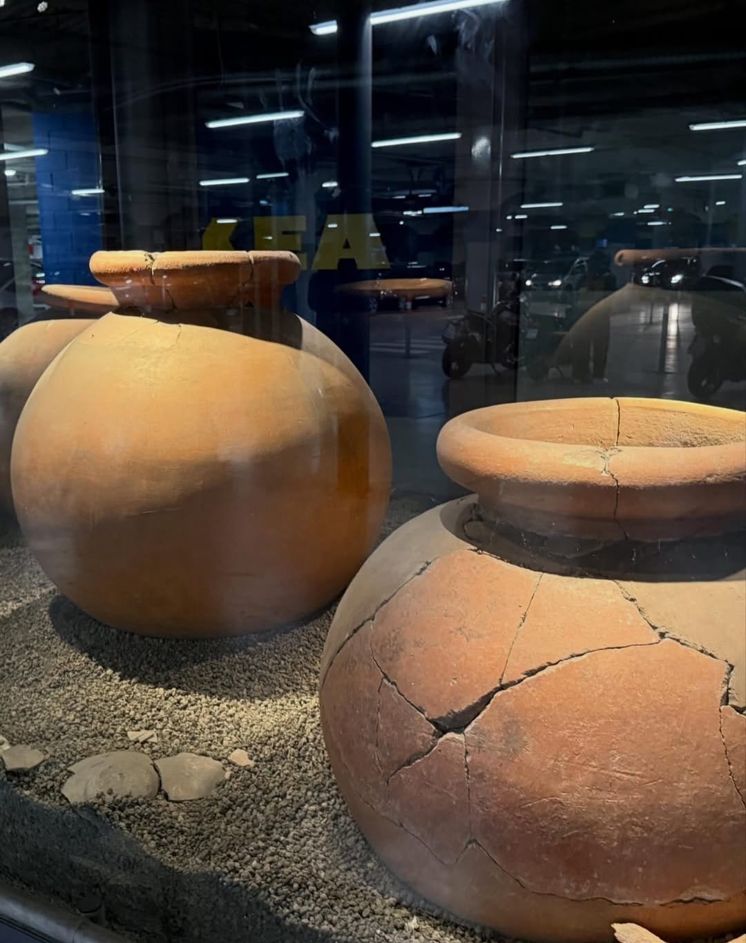
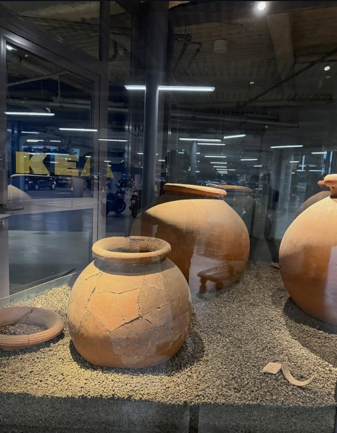
Material displayed at the site includes large ceramic containers associated with the storage of agricultural products.
Reorganisation of the countryside
Agricultural installations and planting systems document repeated use and modification of the territory.
Later documented phases
The sequence recorded by the preventive investigations continues into the final centuries of the Republic.
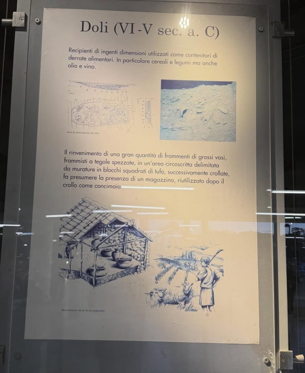
Storage on an agricultural scale.
Dolia were very large ceramic containers used for storing agricultural products. The archaeological display at Anagnina associates examples from the site with the sixth and fifth centuries BC.
According to the on-site interpretation, concentrations of fragments from large vessels and roof tiles were found inside an area defined by squared tufa blocks. Archaeologists have interpreted this as the probable presence of a storage structure.
The same area appears subsequently to have been reused after the collapse of the structure, illustrating how even productive spaces could change function over time.
What survives from an ancient working landscape.
Routes
Ancient circulation routes connected agricultural areas across the suburban territory.
Planting
Trenches interpreted as vineyard planting provide evidence for organised cultivation.
Storage
Dolia and structural evidence point to the collection and storage of agricultural produce.
Land Management
Agricultural improvement systems show deliberate modification and organisation of the terrain.
Archaeology without a monument.
It records ordinary economic activity.
The site documents cultivation, storage and the organisation of agricultural land rather than imperial architecture.
It preserves a long sequence.
Archaeological traces extend across several centuries, allowing changes in land use to be reconstructed.
It changes the map of ancient Rome.
The ancient city depended on a productive suburban territory extending far outside its monumental centre.
It survives inside contemporary infrastructure.
The contrast between archaeology and a modern retail complex makes the continuity of land use unusually visible.
Preventive archaeology before construction.
The archaeological evidence came to light through investigations undertaken in connection with construction of the commercial complex.
This is an important part of the site's story. In a city such as Rome, major construction can become an opportunity to investigate landscapes that would otherwise remain inaccessible.
The Anagnina investigations contributed to archaeological research into the ancient suburb by documenting a portion of countryside whose history could be reconstructed through features left directly in the soil.
The surviving display is therefore only the visible end of a much larger archaeological investigation.
Archaeology in an unusual setting.
The archaeological remains and display are incorporated into the IKEA Roma Anagnina complex. Because this is not a conventional archaeological museum with an independent visitor timetable, current access conditions should be checked before travelling specifically to see the site.
Archaeological Sources
Alessandro Tanzilli
The photographs documenting the archaeological area and its presentation within the IKEA Anagnina complex are by Alessandro Tanzilli. @alessandrotanz_
Design Your Journey
Underground Rome creates private journeys through archaeological sites and ancient spaces selected around your interests, access conditions and time in the city.
Design Your Journey →Underground Rome is the specialist archaeological project of Rome Private Experience. Corporate programmes, incentive travel and complex private arrangements are managed through Rome Private Experience.
Rome Private Experience →