
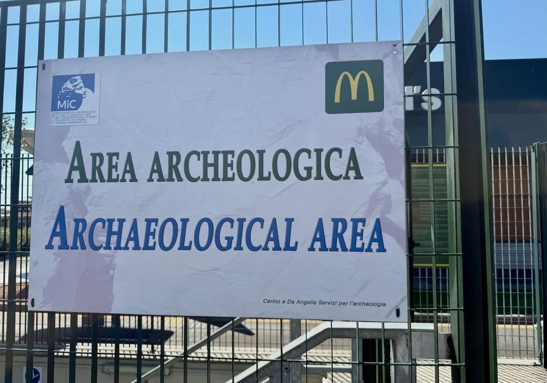
Roman Road
at Frattocchie
Via Appia Nuova
An ancient road inside a contemporary building.
In 2014, archaeological investigations connected with the construction of a McDonald's restaurant at Frattocchie revealed a remarkably preserved section of Roman road.
The discovery was not removed to make way for the new building. Instead, the project was redesigned around the archaeological remains.
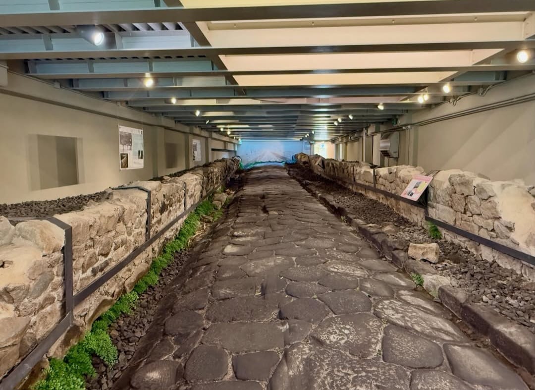
Today the ancient route survives within a dedicated archaeological gallery associated with the modern complex, while parts of the excavation can also be observed from the restaurant above.
The result is an unusual example of archaeological conservation in which ancient infrastructure and contemporary commercial architecture occupy the same site.
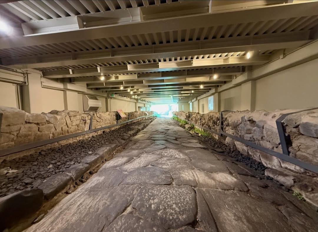
Forty-five metres of an ancient route were identified.
The excavated road preserves the physical structure of a route that branched from the Via Appia.
Archaeological documentation dates its construction broadly between the second and first centuries BC.
The road surface was formed with large paving stones, while the surviving engineering includes lateral arrangements for the management of rainwater.
Its scale suggests a secondary route rather than one of the major long-distance arteries of Roman Italy.
The road survives as infrastructure, not as an abstraction.
Dimensions, paving and drainage allow the archaeological remains to be read as a functioning piece of Roman infrastructure.
Movement and drainage were part of the same design.
Roman roads were engineered surfaces whose construction responded to traffic, terrain and water.
At Frattocchie, the paving preserves evidence for the organisation of the carriageway and a lateral channel associated with rainwater drainage.
The road surface was constructed with a transverse inclination that helped direct water away from the principal route.
These apparently practical details are archaeologically valuable because they preserve evidence for how the road actually functioned.
A secondary route within the road system of the Via Appia.
The excavated road branched from the Via Appia in an area closely connected with ancient Bovillae.
This does not make the Frattocchie road another section of the Via Appia itself.
It is more useful to understand it as evidence for the network of secondary routes that connected settlements, properties and local activity with one of Rome's principal roads.
The discovery therefore helps reconstruct not only a single road, but the denser infrastructure that developed around the Appian corridor south of Rome.
The discovery changed the architecture above it.
Preservation required the modern construction project to respond to the archaeological remains.
Rather than treating the ancient road as an isolated object removed from its context, the solution retained the archaeological evidence in place.
The resulting gallery allows the road to be experienced within the location where it was discovered.
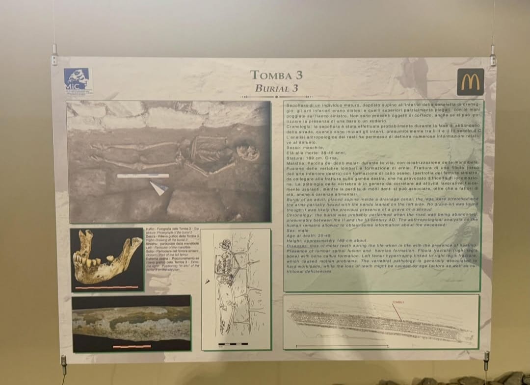
Construction became archaeological investigation.
The Frattocchie site is also a case study in what can happen when modern development encounters archaeological remains.
The new structure was adapted to the ancient one.
The unusual character of the site comes from the direct relationship between the archaeological level and the contemporary building.
A structural solution was developed that allowed the restaurant to occupy the site while retaining the Roman road below.
Portions of the archaeological area can also be viewed from the building above, reinforcing the physical relationship between the two levels.
The result is not the reconstruction of an ancient road inside a museum. It is the preservation of the actual archaeological remains where they were found.
The road remains physically legible.
Paving, margins and surrounding archaeological structures preserve the material form of the ancient route.
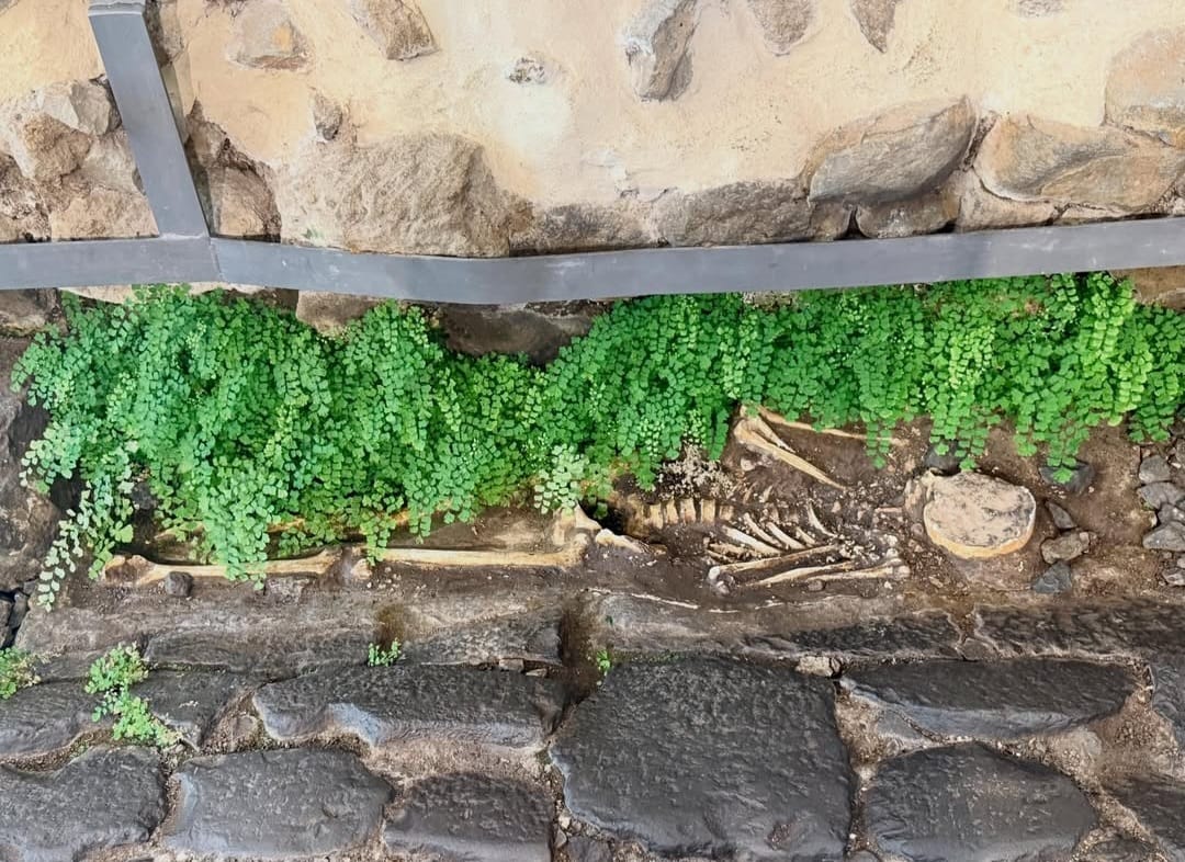
When movement ended, the use of the area changed.
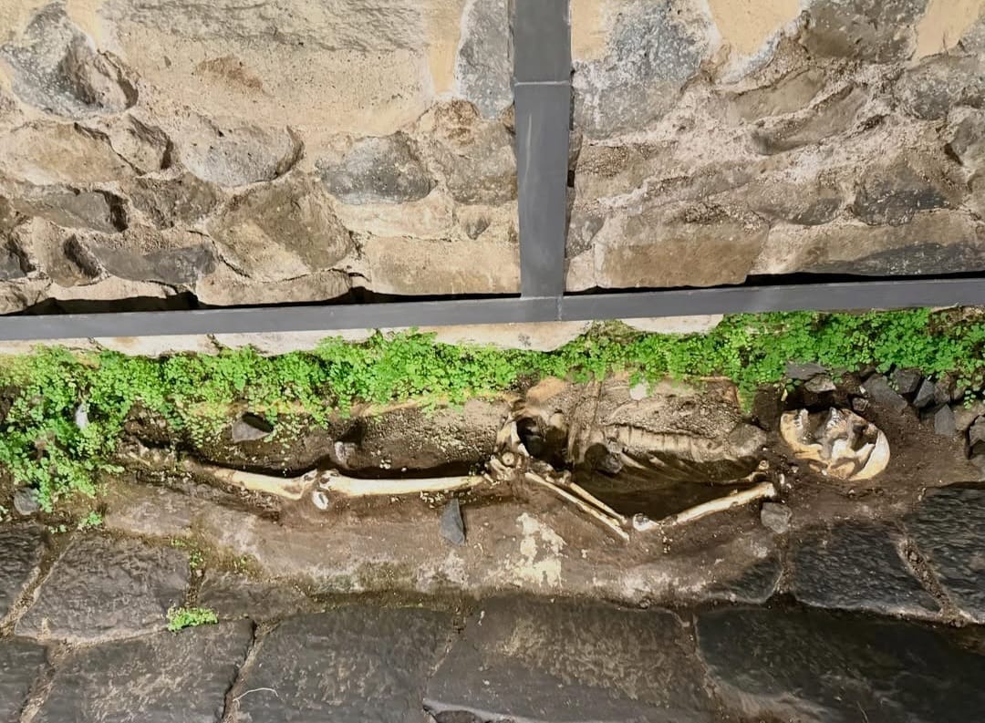
Three burials were discovered in association with the later history of the road.
They belong broadly to the second and third centuries AD, when the road was falling out of use.
Their presence records an important archaeological shift: a space originally organised for movement could acquire a funerary function once its role in the road network ended.
The burials therefore belong to a later phase of the site and should not be interpreted as part of the road's original construction.
Its importance lies in the relationship between infrastructure and time.
The site records several distinct moments: construction, use, repair, abandonment, burial, rediscovery and conservation.
Archaeology does not stop when the modern city begins.
Frattocchie demonstrates how archaeological remains can become part of a contemporary building without losing their physical relationship with the place where they were discovered.
The contrast is striking, but the significance of the site goes beyond the presence of archaeology inside a McDonald's.
It records an ancient transport network, Roman road engineering, changes in land use and the process through which modern construction can reveal evidence that had remained below ground for centuries.
For an archaeological atlas, it is a particularly clear example of how the ancient landscape continues to shape decisions made in the present.
An archaeological area designed for independent access.
The archaeological gallery was created as an area accessible independently from the restaurant.
Institutional information issued when the site opened described access to the archaeological area as free. The route was equipped with interpretive material in Italian and English.
Because opening arrangements may change independently of the archaeological record, current access and opening times should be confirmed before making a dedicated journey.
Contributor
Photography of the Roman road and archaeological area at Frattocchie reproduced on this page with credit to the photographer.
@alessandrotanz_ · Instagram →Explore more archaeological and historic places across Rome.
Explore Rome through archaeology selected around your interests.
Underground Rome designs private archaeological journeys according to available access, your interests and the physical history of the city and its surrounding territory.
Design Your Journeyby Rome Private Experience
Underground Rome is dedicated specifically to Rome's archaeological and historic subsurface.
For broader private programmes across Rome, corporate experiences and complex group arrangements, visit Rome Private Experience .